Plots
A plot of land is the spatial unit Vantage uses for environmental analysis. In the app and API, plots have geometry, metadata, token estimates, and analysis history.
For EUDR workflows, the plot of land is also the regulatory unit used to assess whether a commodity was produced on land affected by deforestation, forest degradation, protected area restrictions, or Indigenous land considerations.
EUDR Terminology
The EUDR defines a plot of land as land within a single real-estate property that has sufficiently homogeneous conditions to evaluate deforestation and forest degradation risk for relevant commodities.
The regulation also defines geolocation as latitude and longitude coordinates. For plots larger than four hectares, except cattle, operators must provide polygons with enough points to describe each plot perimeter.
Geometry Types
Vantage accepts GeoJSON to describe plot geometry. The two primary geometry types are:
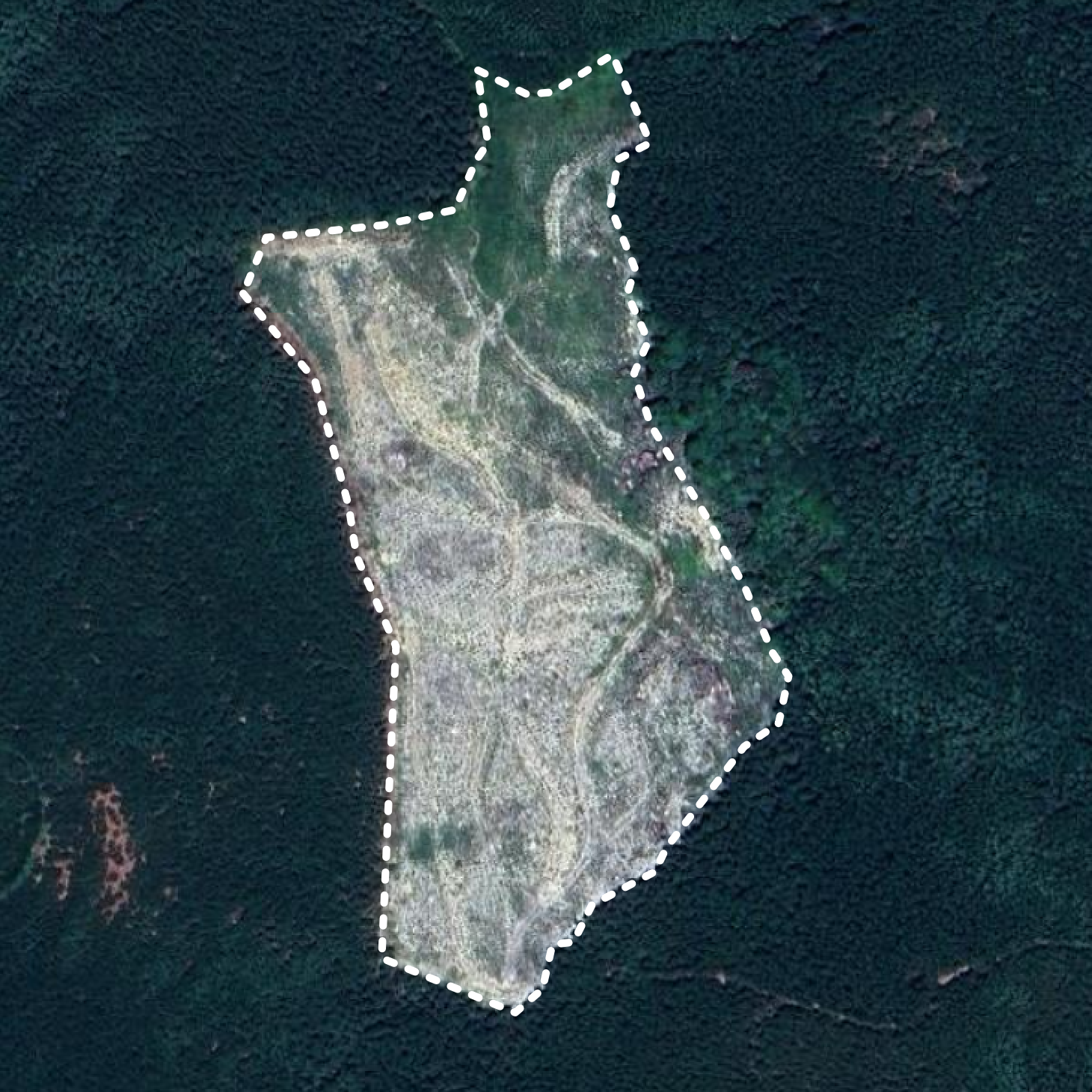
- Polygon: the standard representation for plots larger than four hectares.
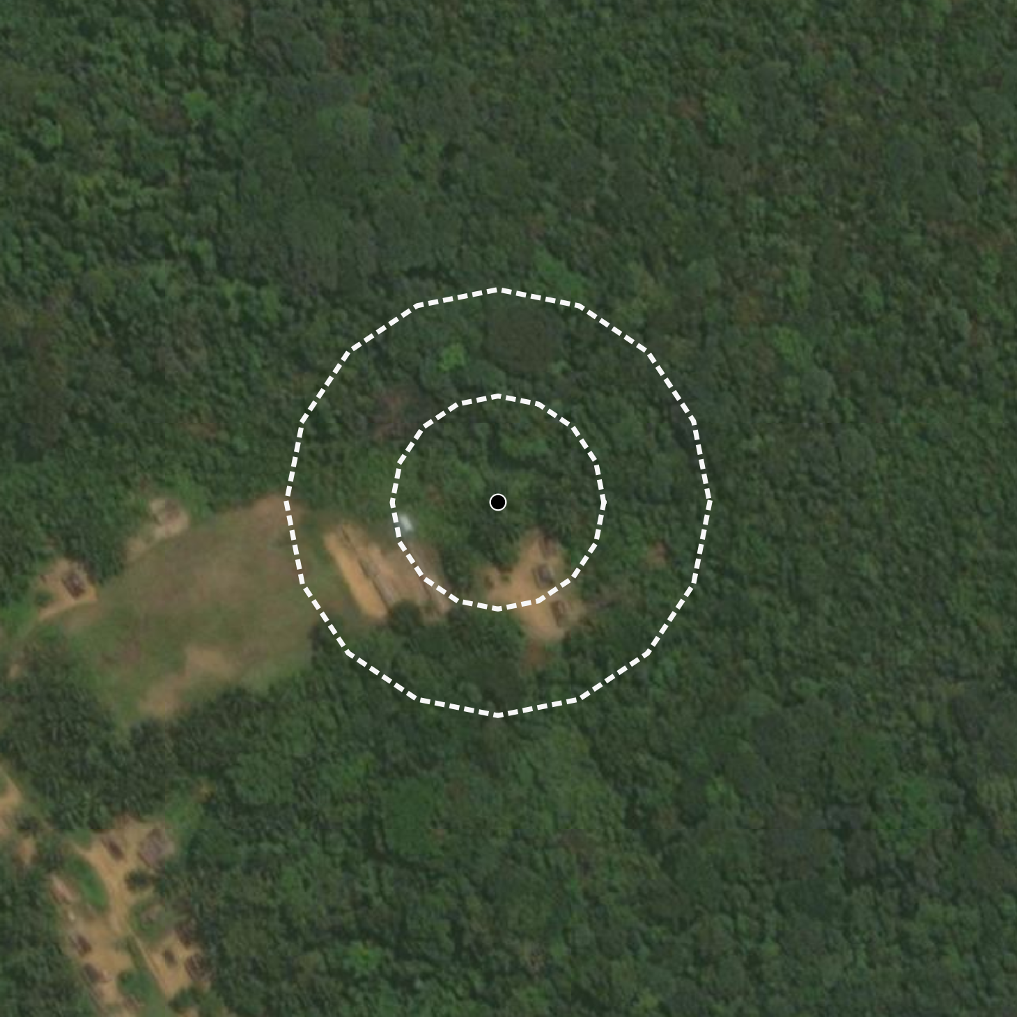
- Point: supported for small plots where a point location is allowed or operationally useful.
When a point is registered, Vantage creates a buffer around it so analysis can run against an area rather than an isolated coordinate. By default, the generated area is approximately four hectares. For smaller plots, the provided area can be used to create a more representative buffer.
The generated area is also used for token estimation. Token usage rounds up by hectare, so a 1.5-hectare plot reserves 2 analysis tokens when it is assessed.
App Plot Creation and Import
In the Vantage app, you can create a plot directly on the project map. This is also available as the first action in a new project: choose Draw on the map, zoom to the site, and sketch the plot boundary. For existing projects, use Create plot from the map.
In the Vantage app, plots can be created from more than clean GeoJSON. The app import flow is built to help teams bring in supplier and project data in the formats they already have, then normalize it into plots that can be reviewed on the map and used for analysis.
Supported app inputs include:
- Geospatial files such as GeoJSON, KML/KMZ, GPX, GML, GeoRSS, TopoJSON, WKT, GeoPackage, Shapefile ZIP archives, and GeoParquet.
- Tabular files such as CSV, TSV, Excel, JSONL, and Parquet.
- Tables with latitude/longitude columns, geometry columns, addresses, place names, Plus Codes, or Google Maps URLs.
- Excel workbooks with multiple sheets, non-data title rows, or unusual header placement.
- Datasets with multilingual or non-standard column names, where the app can help identify geometry, address, and metadata columns.
When rows do not already contain geometry, the app can resolve addresses, places, or map URLs into candidate plot locations. Imported rows keep provenance and warnings where relevant, so reviewers can see which values were parsed directly, resolved from location text, or normalized during import.
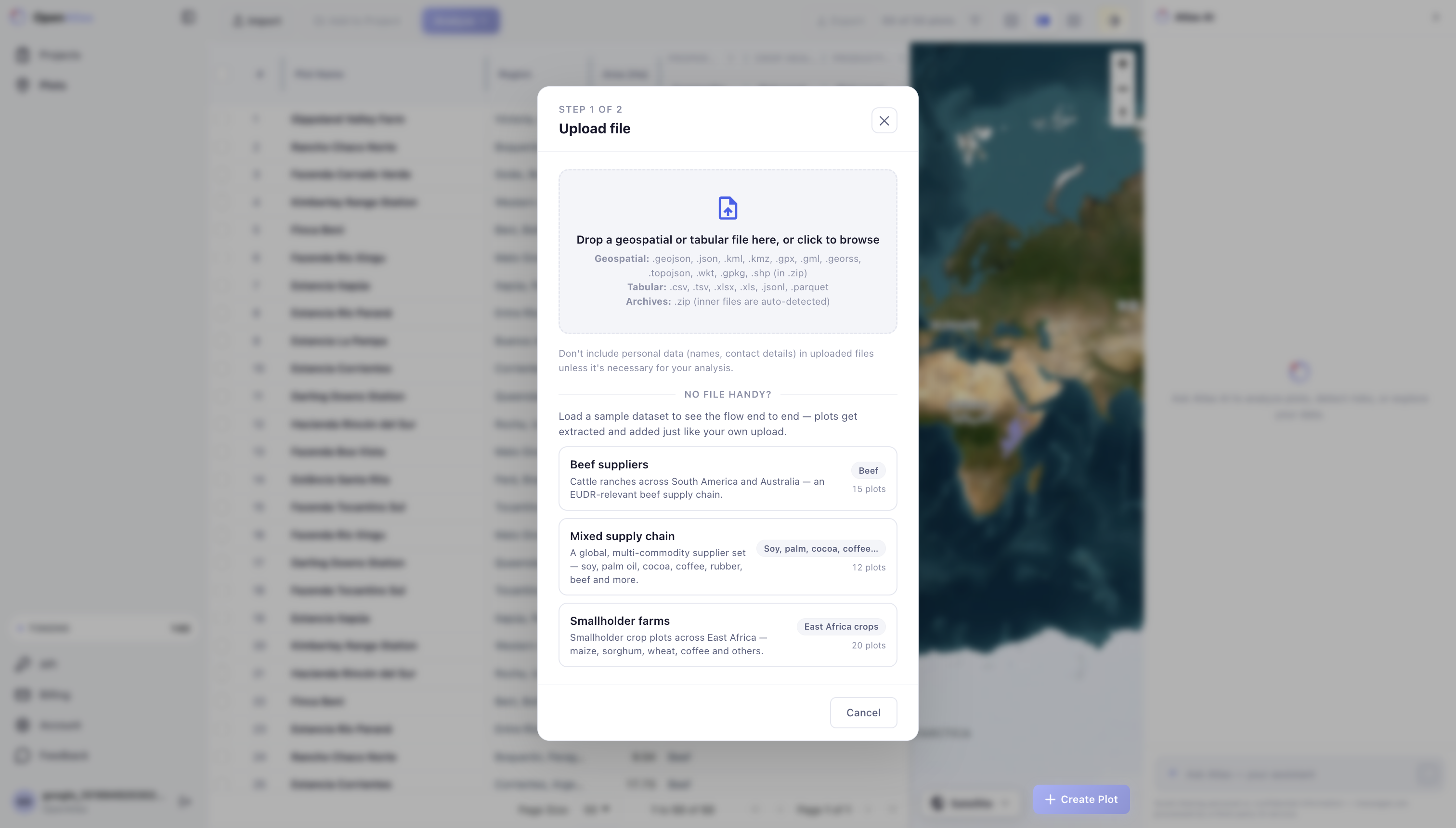
The public API currently documents plot registration using supported request schemas and GeoJSON geometry. Treat the broader import and resolution capabilities above as Vantage app functionality unless they are explicitly documented in the API Reference.
Plot Examples
Polygon geometry |
Point geometry with generated buffers |
Validation
Vantage validates geometry when a plot is registered or imported. This helps teams catch issues before running analysis or preparing EUDR submissions.
Common rejected cases include:
- Polygons that are not closed.
- Polygons with too few unique points.
- Self-intersecting or unrealistic geometries.
- Unsupported geometry types for EUDR plot declarations.
- Coordinates outside valid latitude or longitude ranges.
Some technically imperfect geometries can still be accepted when they are safe to process, such as polygons with duplicate nodes, inner rings, or third-dimension coordinates. The third dimension is ignored.
For detailed EUDR-specific validation rules, see Data Requirements.
Metadata
Plots can include metadata that helps organize and run analyses:
plot_name: a readable name for the location.notes: optional context for reviewers.commodity: an EUDR in-scope commodity, such aswood,soy,cocoa,coffee,palm_oil,beef, orrubber.harvest_date: the production date used for time-based analysis.additional_info: customer-specific metadata such as supplier, owner, or internal identifiers.
Commodity and harvest date can be supplied at plot registration or later when an analysis job is created. Commodity must be available before an EUDR analysis can run.